
3Ds PLAN ORBITS Tech Present the GIS Course in RawalpindiPakistan for Mapping with Arc Map which is esri software.
In modern world We can gaining information from web software’s even base map or raster data sets.
Course Details.
First Basic concepts of GIS Geographical Information System.
Georeferencing with Google Earth or any base image gaining even from topo survey and other sources.
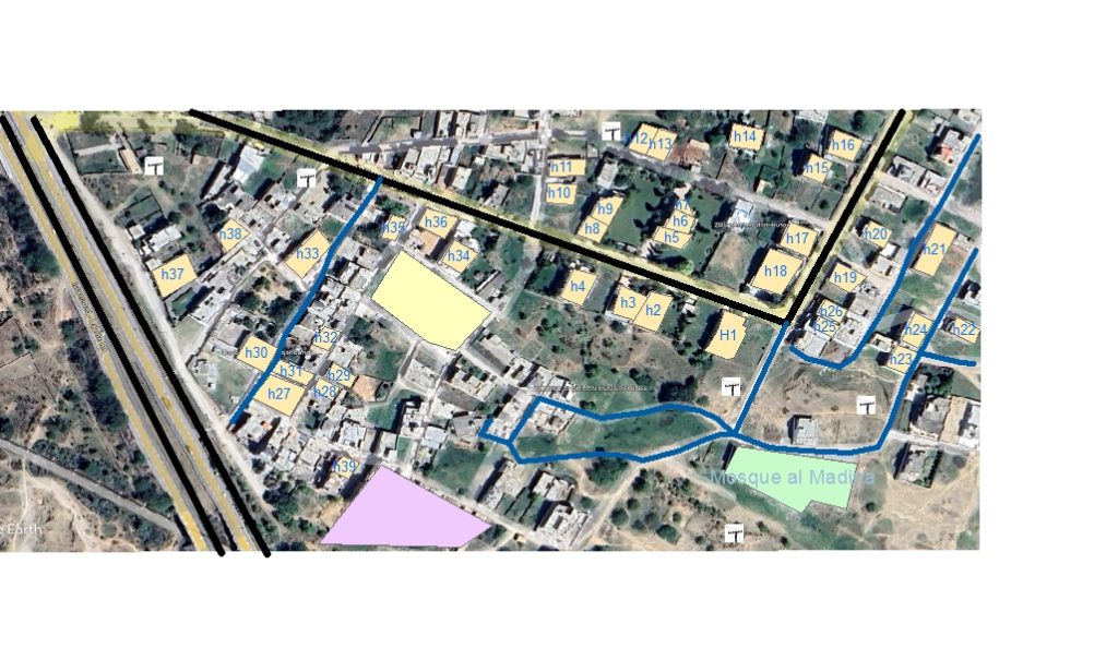
Digitalization of map with vector data as like , Line , polygon , circle , point rectangle etc.
Attribute Table and the use.
New fields added and with text , Double date or others.
Centroid Points added with xy location as Lat Long from shape file.
Measure length of shape file.
Calculate the area of any feature class or layer.
Add the text for various purpose.
who show the shape file labels.
Geocoding and Addresses tool who we can use and the purpose of use.
Topology creation with geo data base , feature data set and feature classes.
Merge , Union , Clipping and others geo processing tools with way of use in Arc Map.
Geo data base , Domain of geo data base and purpose of use.
Tracking with time period and who display the presentation in Arc Map.
Project tool creation and the advantages of projection or project tool.
Automatic area and length of shape file creation from project tool.
Kml or kmz file creation and export to Google Earth for presentation purpose.
Shape files location showing at the world map with added base map if possible added online map.
Points data which is available in csv or excel format insert in the Arc map file.
These coordinates convert in to the shape file of points data and layer file.
Finally we calculate these coordinates of objects in Attribute Table.
symbology added instead of shape files as like houses , Trees , Electric Pools , Vehicles , Wells with different scales and styles.
Although scale of symbology may be different in all fields but look similar.
Above all information in GIS Course in RawalpindiPakistan 3Ds Plan Orbits Tech.
Because of importance of Civil surveyor know details.